Steinsburg and Gleichberge near Römhild
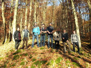
In 2015, the “Cultural Landscape History” project brought students from the “Landscape Architecture” master course to the “Gleichberge” near Römhild. Like hardly any other region in Thuringia, this area in the Thuringian-Franconian border area has an extremely long and varied history of settlement.
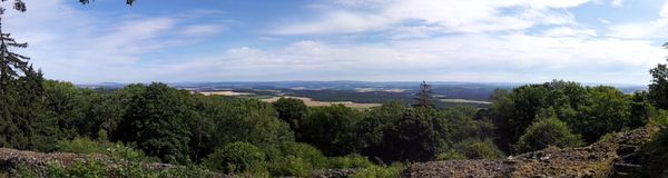
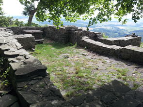
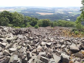
The “Gleichberge” are relics of tertiary volcanism. The striking and widely visible basalt cones offered excellent settlement conditions due to their favorable location between southern and central Germany and their fertile surroundings (loess areas of the Thuringian “Grabfeld”). Several archaeological sites of supraregional rank can be found here, including the "Steinsburg", which is known beyond Thuringia (remains of a Celtic castle complex on the “Kleiner Gleichberg”).
The aim of the project work should be to record and document important traces of the cultural landscape inventory and to develop maintenance, protection and development options tailored to this. For this purpose, a topic-specific literature and internet research was carried out by the students. In order to gain a deeper impression of the cultural landscape around the Gleichberge, a day excursion took place on November 4th, 2015, during which selected objects were visited (e.g. ruins of the “Steinsburg”, hollow paths, quarries, springs etc.). After the evaluation, the main task was to prepare a study paper and a map on the individually chosen topic.
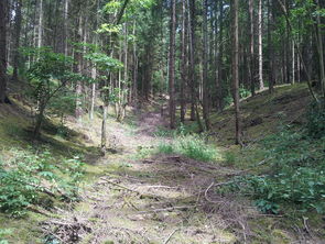
(photo: H.-H. Meyer)
(photo: H.-H. Meyer)
(photo: H.-H. Meyer)
(photo: H.-H. Meyer)
Selection of theses
- Brunnen und Quellen Claudia Barnkoth Portal.pdfC. Barnkoth: Wells and springs on the Kleiner Gleichberg
- Hohlwege Kl Gleichberg Tobias Paschke Portal.pdfT. Paschke: Hollow-ways on Kleiner Gleichberg
- Steinsburg Kl Gleichberg Axel Bubholz Portal.pdfA. Bubholz: The Steinsburg. A Celtic hilltop castle