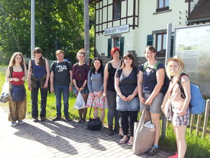
(photo: H.-H. Meyer)
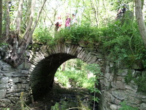
(photo: H.-H. Meyer)
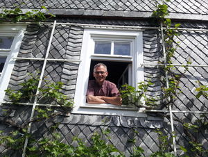
(photo: H.-H. Meyer)
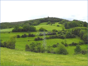
(photo: F. Rose)
Cultural landscape analysis in the village of Bechstedt
Project in the master's program
Head: Prof. Dr. I. Marschall, Prof. Dr. H.-H. Meyer, Dr. Thomas Büttner
In the summer semester 2014, the small village of Bechstedt-Trippstein, southwest of Rudolstadt, was the focus of an exciting field project of the master's program of Landscape Architecture. A group of 12 students, specialized in "EU environmental guidelines and cultural landscape development” as well as in “open space planning and garden preservation", were to carry out a cultural landscape analysis of the location.
The aim was to practice the methodological competences of recording and evaluating historical cultural landscapes with the help of different tools. Methods of model, scenario and measure development had to be practiced and communicated to the local public. A final presentation and discussion of the results in the planning area formed the conclusion of the project work, which brought numerous new insights into the development of the regional cultural landscape.
Bechstedt-Trippstein is situated on the edge of the Thuringian Slate Mountains. Not far from the Schwarzatal it is embedded in a picturesque hilly landscape at an altitude of about 370 m above sea level. The community has about 160 inhabitants.
In order to get a first overview of the special landscape structures and potentials, at the beginning of the project all available historical and natural spatial map works were evaluated by means of GIS. For example, the geological subsoil, the soil, and the potential natural vegetation conditions, the water network were recorded. Particular attention was paid to the local historical cultural landscape elements and historical land uses, which were taken from the old maps and plans and digitized in precise locations. After the preparatory phase, a two-day on-site mapping followed, in which glimpses from present cultural landscape elements of historic character in the village center and in the open fields were recorded. This made it possible to compare what is still present today and what has been lost.
Discussions with contemporary witnesses, regional experts and farmers consolidated and illustrated the information that was gained from the maps and terrain reports. Specifically, the students addressed the following topics in groups:
• Historic Settlement Structures (e.g. characteristic buildings and structural details, use of local natural stones)
• Orchards (Mapping of the variety of over one thousand fruit trees in the community area, localization by GPS)
• Historical land uses (e.g. irrigated meadows and agricultural terraces, clay pits, quarries)
• Change of use (map and aerial analysis of the land uses around 1800, 1850, 1938, 1953, today)
• Forest and hunting history (traces of historical forest use, princely hunting ground, pleasantry)
• Associative Places (storytelling trees and other legendary localities, postcard views).
A visit to the castle of Heidecksburg in Rudolstadt also provided interesting insights into the historical holdings of the Thuringian State Archives. The results of the project work were presented in front of many guests on July 30, 2014, at the KulturNaturHof in Bechstedt. The collaborating partner and host on site was Dr. Burkhardt Kolbmüller. The project report with many maps and extensive explanatory text can be found in the pdf files below.